
Dothan Previous Resident Sources
An address history changes shape by era. Current property and land systems are the best starting point, but they document ownership more clearly than occupancy. Mid-century city directories and the public federal census supply household clues. The Dothan Eagle adds obituaries, sales, legal notices, and social items. Permits help date work on a structure. When an online index stops, the Houston County courthouse and Alabama archives become the next access channels.
| Historical source | Confirmed span | Place to obtain it | Evidence it contributes |
|---|---|---|---|
| Houston land index and instruments | Online start unknown to present | Probate Recording and Ingenuity | Owner chain, legal description, dates, transaction addresses |
| Houston deed books or microfilm | County created in 1903; exact runs unverified | Courthouse and ADAH catalog | Earlier links before the online range |
| Dothan city directories | Verified holdings from 1959-2001, with gaps | Wiregrass Archives and ADAH | Listed residents, addresses, and volume-specific details |
| 1963 telephone directory | One verified digital artifact | Library of Congress | Subscriber and address after manual entry review |
| Federal census | Public person-level schedules through 1950 | National Archives and library databases | Household members and enumeration order |
| Dothan Eagle | September 24, 1909-present | DHCLS Local History Room | Obituaries, transactions, legal and social notices |
| Dothan permit sheets | Examples verified for 2025-26; start unknown | City PDFs and permit office | Project address, date, type, contractor, and some costs |
Start with the row nearest the target date. For a modern owner, begin at Revenue and Probate. For a mid-century household, begin with a directory or census. A source that names an owner does not settle who lived there, and a subscriber listing does not identify every person in the home.
Anchor Dothan Residents to Parcels
Enter the address through the Houston County property record gateway, then copy the parcel identifier and full legal description. Confirm the jurisdiction as well. A Dothan postal line does not prove that the land falls inside city limits, and small parts of Dothan's wider urban and postal area approach Dale and Henry counties. The correct county controls which probate office holds the deed.
The property form exposes Tax Year, Search Type, Search Terms, and Subdivision. Its dynamic option lists were not verified, so select only what the live form offers. A tax roll identifies an owner, not all previous residents. Keep the situs address, meaning the parcel's location, apart from the owner mailing address, which is where tax mail goes.
Reverse Houston County's Deed Chain
The Houston County Judge of Probate is the recorder. Its official online land-record instructions say search and viewing are free. No account is needed for pay-per-document access, downloaded pages cost $1 each, and purchased documents stay in an account for 30 days. The county does not state the first online year. Searches work best with the last name first, no punctuation, and fewer fields. An Index Filter can narrow a broad result set.
Walk backward from the current parcel rather than guessing at a former name:
- Copy the current owner, parcel identifier, and legal description from Revenue or GIS.
- Find that owner's purchase deed in Ingenuity. Save the grantor, grantee, date, record identifier, and derivation or source reference.
- Search the seller as an earlier grantee. Match the legal description before accepting the link.
- Repeat the seller-to-buyer chain until the online index no longer supplies the needed instrument.
- Call Recording at 334-677-4723, consult courthouse deed books, and check ADAH's Houston County microfilm records.
- Grantor
- The person or entity transferring an interest in the property.
- Grantee
- The person or entity receiving that interest.
- Chain of title
- The linked series of transfers for the same parcel.
- Legal description
- The land description tied to a plat or survey system. It remains useful when a street label changes.
The county's land-record access page shows the official route into this Dothan previous residents workflow.
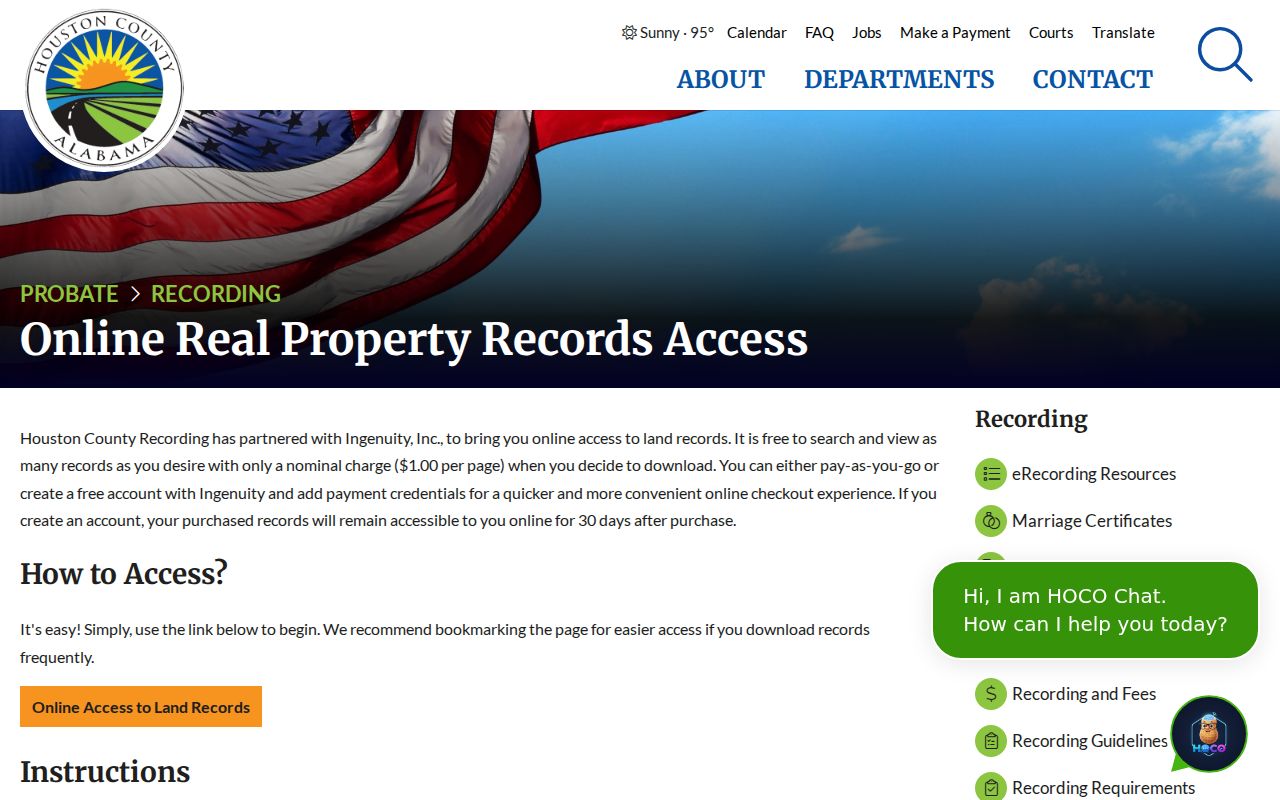
The screenshot supports the search and copy path, while the actual deed supplies the identity and parcel facts.
Read Dothan Deed Identity Clues
A recorded conveyance can carry more than two names. Houston County requirements call for the preparer's name and address, grantor or mortgagor marital status, grantee or mortgagee mailing address, a complete legal description, a derivation clause, and printed names below signatures. Since August 1, 2012, a conveyance must also supply actual purchase price or value in the instrument or a Real Estate Sales Validation Form. These fields can keep two same-named owners apart.
Mailing and physical addresses remain distinct. Neither one alone proves who slept at the property. Use the legal description to confirm continuity, then treat transaction addresses as clues tied to the deed date. The county's recording fee schedule sets the page-copy charge plus the stated $3 certification fee. Certification proves the copy came from the custodian; it does not resolve identity by itself.
The Houston County recording guidelines show why a deed can contain a rich set of address-history facts.
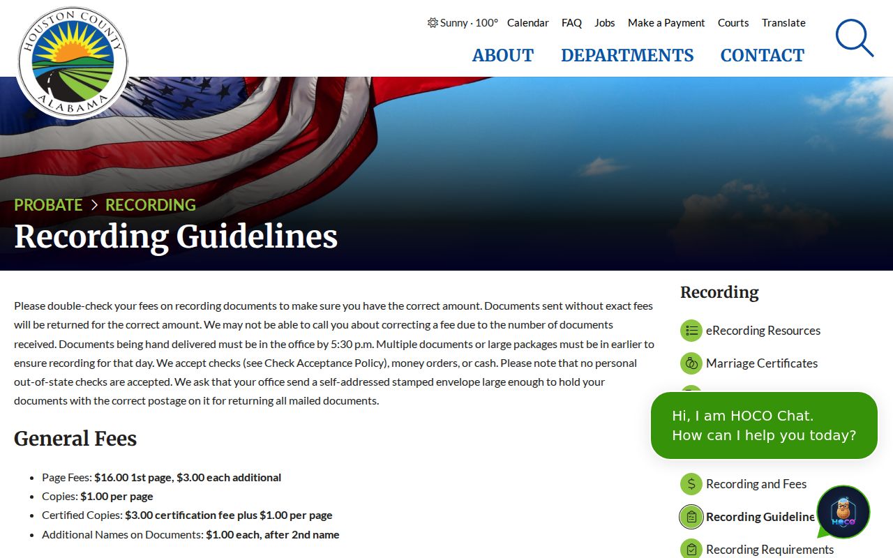
Those required fields create the bridge from a parcel to prior instruments without turning ownership into a claim of occupancy.
Note: Use the instrument's derivation and legal description together when a surname search returns several plausible Houston County deeds.
Dothan Past Residents Between Censuses
Ownership is only one layer. Verified Dothan directory holdings span 1959 through 2001 with gaps. Wiregrass Archives holds fifteen named Polk volumes from 1967 through 1991, while ADAH holds additional Dothan years through 2001. A 1963 United Telephone & Telegraph volume is free through the Library of Congress. The detailed collection lists belong on the Dothan city directory page; for an address trail, use each book only to test a specific year and address.
Pair the printed entries with the 1950 federal census, the latest public person-level schedule. This short flow keeps evidence in order:
- Locate the parcel's old street label in the nearest available directory.
- Copy the listed name exactly and read the volume's abbreviation key.
- Compare nearby directory years for a move, surname change, or new subscriber.
- Match a 1950 household by address, kin, age, and enumeration context rather than surname alone.
- Test later changes with deeds, Eagle notices, probate files, or cemetery records.
A missing entry can mean a move, death, spelling change, unlisted telephone, or missed canvass. It is not a firm end date. Likewise, the regional 1963 telephone book covers several Wiregrass exchanges, so confirm the exchange heading before calling a subscriber a Dothan resident.
Bridge Changed Dothan Street Labels
Dothan's annexation packet warns that annexation may change a street number or street name to meet E-911 standards. It also states that annexation does not guarantee city water, electric, sewer, or road paving. Thus a mailing address, municipal jurisdiction, service status, and property identity may all tell different stories. An old address can disappear while the parcel stays in place.
Return to the parcel identifier and legal description whenever an address search breaks. Annexation petitions can add all record-owner signatures, parcel ID, legal description, and a map showing contiguity with city limits. Planning at 334-615-4410 and the City Clerk at 334-615-3160 handle the municipal side. The E-911 Addressing Agent at 334-615-4437 is the verified correct-address contact.
Stable bridge. An old street number is a clue. Parcel identity and legal description are the safer way to connect Dothan previous residents across an annexation change.
Dothan Records Date the Building
Monthly Dothan permit sheets can mark a change to the structure. Verified residential and commercial examples list permit number, type, issue date, address, contractor, subdivision, total area, valuation, or fees depending on the month. The public examples are from 2025 and 2026; the start of the digital archive is not established. For an older address, request a narrow record by address and date from Building Inspection Services.
The city permit page supports portal applications and tracking, plus email and in-person submission. It does not promise a complete public historical address search. Sanborn fire-insurance maps can show footprint, materials, stories, use, lot lines, road width, and water facilities, but no authoritative Dothan-specific sheet years were verified. Search the Library of Congress Sanborn collection and record an exact edition before citing it.
Close Dothan Resident Trails
The DHCLS Main Library Local History Room holds Dothan Eagle microfilm from September 24, 1909 to the present. The film stays in-house, and copying or printing may carry a charge. Search around a deed date, last directory appearance, or known death. Obituaries may identify relatives and former homes; legal notices can tie names to estates or parcels; social items can explain a temporary absence.
When the trail ends in death, Houston County Probate may name a personal representative, heirs, claimants, and property, subject to confidential or sealed material. Open-estate updates are available through the Probate Records mode or by calling 334-677-4701. Dothan City Cemetery and North Highland Cemetery provide searchable-name PDFs and block maps, while Engineering Services researches lot ownership for lineage questions at 334-615-4420.
One local story shows why these sources matter. A 2024 Wiregrass Archives oral history recalls Southside demolition during urban renewal and a family move to Lakeview. A directory address can vanish because the built landscape changed, not because the family simply left Dothan.
Limits of Previous Resident Records
No Dothan record creates a full list of everyone who occupied a home. Tax records miss renters and other household members. Directories omit people who were unlisted or missed. Census schedules become public only after the federal waiting period. Utility customer data is not treated as a public resident roll. Protected addresses and sealed files remain outside ordinary access.
Keep conclusions narrow. Say a deed names an owner, a directory lists a subscriber, or a census enumerates a household. Do not collapse those facts into one claim unless independent records agree. Corrections belong with the custodian that holds the source.
Lawful use. Trace previous residents for family history, property history, estate work, or personal curiosity. Never use an address trail to stalk, harass, threaten, or harm a living person.